Indigenous cartography: how Indigenous cultures map the landscape

Māui catching the North Island (Te Ika-a-Māui) of New Zealand.
The mapping of landscapes has long been a necessity for human survival.
For hundreds of years, communities have thrived in their environments by using maps that look different from what many of us would now visualise upon hearing the word. Cartographic information is not limited to representation on paper. Commonly, it exists in the mind, developed through cultural practice and oral passing of knowledge from generation to generation. Cognitive spatial conceptions have enabled communities to succeed in navigating within ocean and terrestrial spaces and survive challenges that nature imposes.
In Polynesian communities, for example, their comprehensive education in topography, cloud forms, wildlife migration and ocean swells is laden with morals and values. Conceptual compasses are developed in youth through the storytelling of myths and legends of how the shape and terrain of landscapes came to be. Some Indigenous New Zealand Māori tribes share the story about their ancestor Maui hauling up an enormous fish, despite his brothers laughing at him in disbelief that he is capable of catching fish. These Māori communities know the country’s North Island as Te Ika A Maui (the fish of Maui), referencing the long spit of land as the fish’s tail and reinforcing to new generations this lesson about perseverance and bravery. Proverbs, song and dance also share stories about stars, tsunamis, and the migratory routes of whales and birds, alongside lessons about family, identity and values.
Māori stories encompass a spiritual explanation for natural life systems: that people, trees, rivers, mountains and birds share the same ancestors in the sun, the wind and the water. Māori understand their obligation is to protect the environment and continue the legacy of their ancestors. With the knowledge gained from mythology and cardinal direction sourced from nature, Māori culture developed little need for physical maps. Even in the night, the merging of storytelling and astronomy is used to navigate through the Pacific.
Many pacific island communities developed an ability to use celestial navigation to travel across the vastness of the Pacific Ocean. Experts educate youth on how to recognise constellations and use star position to understand one’s location in a landscape of empty blue. When a sailor recognised a star pattern, such as the Southern Cross, they could then observe its position in relation to the horizon to judge their latitude and direction of travel. These teachings were incorporated into spiritual narrative.
As well as storytelling and studying nature, language can be fundamental to the knowing of cardinal orientation. For example, the Guugu Yimithirr, an aboriginal community in the far north of Queensland, describe space using absolute orientation. Instructions describe location as a fixed position, similar to the coordinate system, where the angle of which the speaker is facing is irrelevant. Instructions may sound like, “Place this on the Eastern table” or “Walk North”. Contrast this with English where instructions often rely on a relative object to communicate spatial orientation so that directions may sound like, “Move that in front of (that table)” or “Walk straight ahead and turn to your right”. This is sometimes referred to as egocentric orientation, and it gives a person or object an important role in the context of the spatial description, where they are a landmark to which locations around them are relative to.
Guugu Yimithithrr use absolute orientation to construct a profound mental map of their placement within a landscape, resulting in remarkable navigational abilities. While driving through winding roads of unfamiliar country, speakers of Guugu Yimithirr are immediately able to point in the direction of coordinates or landmarks. The Guugu Yimithirr have also developed the ability to navigate at night when vision is obscured and there is no sun to provide guidance. Constant practice of spatial awareness has been fundamental to achieving these abilities.
Indigenous cartographies generated through studying waves, weather and animals, have accuracy similar to geographic information system (GIS) software, which is increasingly perceived as the finite method of mapping the world.
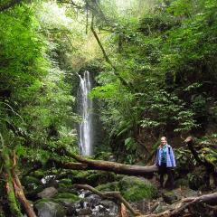
the Guugu Yimithirr.jpg

The Guugu Yimithirr people of Australia
Certainly, GIS mapping is a key player in land management decision making across the globe. It is effective in communicating physical conditions, for example, showing areas where soil is unstable to build houses upon or areas at risk of flooding from stormwater drainage. However, so much of the environment’s story is often excluded from these datasets. GIS mapping systems do not factor in a land's history, culturally significant landmarks or values of those who occupy the land. It can also serve as a tool to reinforce and justify colonial land claims by bearing the territorial lines and place names that were determined by colonisers—both of which have little relevance to the environment the text is placed upon.
In the most culturally different corners of the world, it would be unsurprising to find identical maps hanging on school walls, bearing the territorial lines originally drawn by European colonisers. There’s a quote by American geographer Bernard Nietschmann: “More indigenous land has been claimed by maps than guns.”
It is often with unquestioning mindsets that we take Eurocentric maps as our window to comprehending the world geographically. This acceptance of maps as factual depictions of land can give maps the power to construct our sense of reality. This is dangerous because maps are not isolated from political agendas.
Indigenous cartographies provide valuable understandings of place, direction and environment. Many cultural aspects in Indigenous communities are attached to this understanding, with it embedded in art, speech and rituals. This knowledge, if circulated and included in far-reaching communication platforms, can be utilised worldwide to assist environmental research and land use projects everywhere.
Hawaiian Indigenous cartographer Dr Renee Pualani Louis stresses the necessity to not only include Indigenous epistemology in GIS products but to educate communities about the power that maps have in representing social and cultural conditions. She says, “Only then can Indigenous people become truly empowered cartographically, because only then can they say with certainty which parts of their world can and should be mapped and which parts cannot or should not be mapped with any tradition but their own.” Supporting Indigenous cartographers in their careers will ensure progression towards better representation of Indigenous perspectives in geospatial land analysis.
“It is my belief that Indigenous peoples need to reawaken the imagery of their cultural heritage, re-create the mental maps of their ancestors by practising our oral and performance cartographies and, where appropriate, incorporate modern-day cartographic techniques by adapting them to their cultural epistemologies,” Pualani Louis says.
Several projects have been designed to produce maps in which Indigenous communities control land representation. A counter-mapping project led by Digital Democracy began in 2015 to develop maps of Waorani territory that represented the cultural and social value of Ecuadorian land to the Indigenous Waorani communities who have lived there for thousands of years. In this process, all members of the community were invited to draw their knowledge of the land’s features on paper. While collecting GIS data from hand-held GPS tools, the mapping team listened to the stories of village elders. Data was logged in a GIS software and the map projected for the community to view before finalising for print. The project has mapped over 70,000 acres of land.
In today’s social structure where land-use decisions are largely influenced by scientific and objective evidence, geospatial technology has the power to empower Indigenous communities. GIS maps provide visual evidence to support Indigenous belief systems and opinions about how land should be used. By incorporating traditional cartographies that communicate a deep knowledge of wildlife, terrain and the relationship of people with the environment, maps can begin to meaningfully serve communities and the environment.
As Pualani Louis argues, it is maps that integrate Indigenous epistemologies—and which reflect the features of significant value to communities within that landscape—that can help realise Indigenous opinions and cartographies so that they are not erased from society by the expanding shadow of the colonial lens.